A little, tiny bridge, no more than 6 meters long and maybe one wide, in the middle of two fields. The next river more than 50 meters far. Butlers Bridge seems more a mystery than a real bridge standing in the middle of nature, trees and.. rubbish. But like always when something is hidden and seemingly useless there is history behind. Old stones that have to tell a little story. In this case already the name gives a hint to what history it could be here.
My landlord in Ireland has a lot of land and between two of his fields there are some arches standing, hidden by bushes and rubbish. It’s a while I pass there when I take a walk in the fields. And every time I thought ”Who knows what those are?”. Now I know and my landlord decided one day to do something with those ancient stones.
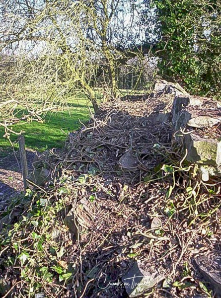
His first steps were cleaning around the mess and have a closer look at it. It didn’t look really good though. Stones falling apart, the top of the arches on the other side fallen already and the walk path over the bridge really invisible, hidden under a thick green cover of ivy. That was the first impression.
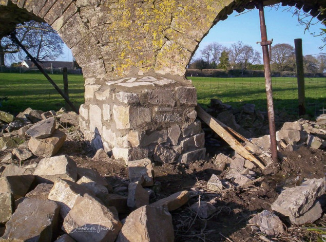
A few day work gave a better view of it. The main pillar in the middle, holding the structure, was so thin at the bottom that the risk to crash down was near. That would be the first thing to fix. After that maybe a wooden construction around the arch on the other side would give a possibility to put back the arch stones. The sides of the bridge were well held by two trees growing just there where normally one should go on the bridge. But cutting them down the bridge has too much space and will widen within a short time and loose all the other stones, I presumed. The ground on which the bridge is built is soft and very wet. Like nearly all fields in Ireland apparently.
Now there was an important question: why there is a bridge in the middle of a field? Normally people built a bridge over water, I thought. Where are the troubled water? Well the width of the bridge let think it must have been also a bigger, deep and really troubled stream. It’s the river Skane that flows 50 meters along, straight and without even one curve. I always thought that it is unnatural, maybe realigned. And so it is: between 1814 and 1836 it has been redirected to the flow of today. On a satellite pic it is clearly visible that before it was a corkscrew river. And it is clearly visible that it flew under the forgotten bridge of today.
Some history around the bridge’s property: On the other side of the field there is a house (where I live) and a gate called Decoy Gate. It was once the main entrance to Bellinter House which is still here (half a mile further) but only with a little piece of land (a park) and nowadays a hotel. The bridge is called also Bellinter Arches. This Decoy Gate was the main entrance because at that time there was no bridge over the Boyne River which flows on the other side back behind the Bellinter House. Now there is one down the road, the Bellinter Bridge, but maybe then too far from the estate.
The name Decoy may come from the fact that there where ponds with fish and ducks being captured here. On ancient maps there is a pond in the small ‘once-upon-a-time’ wood between the today’s road and the Skane river. Where today is the main entrance of the Tara Golf Club there was once the Green Gate of Bellinter – all land that was once owned by Bellinter Mansion long time ago. The ”Gold Course” was the Deer Park of Bellinter.
The name of Butler’s Bridge, or Butler’s Hole as it is known too, comes out of the local folklore. It is said that a butler drowned there – a strange imagination today with the dry land under the bridge. But how the bridge is built it must have been troubled water under it – the bridge has been very massive. Maybe the butler walked home in the night after being in a pub, drunken, falling from the bridge and bending his head, face down, unconscious drowned.
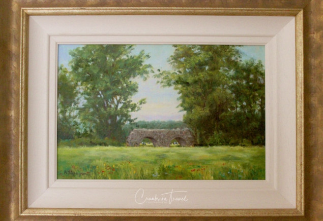
It is a two arch bridge out of heavy local stones. Every arch is about nearly two meters wide and once maybe also deep. The middle pillar is about one meter large and very massive and has two sharp edges to ‘cut’ the flowing water. The bridge is more or less 4 feed large, means a bit more than one meter.
It is said that a footpath was running from nearby Castletown through the Cluide Wood across the river Skane and to Bellinter House. And the most logical point for that is where the bridge is exactly today, in front of the Decoy Gate. Shown on maps of 1830 there is no footpath anymore to the Deerpark and so it is thought the bridge must be from the early 18th century – maybe earlier.
Before the 1950’s the area was full of woodland and wonderful bridle paths and cart tracks. Then the landscape changed to the one of today to give space for agriculture.
About the story of the bridge and Bellinter I had the honor to read a part of a book that still has to be printed. An author living here nearby and originally from County Meath (and a friend of my landlord) is writing a book about the roads of ancient County Meath and how they are nowadays.
The bridge is rescued and looks again like a bridge – just the wild river is missing. But at least this way no one can drown.

For more information:











Interesting article. It reminds me of an ancient Roman bridge in the middle of a field north of Graz, Austria
How does that bridge look like? Needs some rescue? Here are the experts 😉